Since there is constant systematic gaming of the voting landscape in an ongoing effort towards the elimination of a country of-by-for We The People, I decided to revisit this topic of Congressional Apportionment.
There are already methods in place to accomplish redistricting, yet the only way to help ensure non partisan fairness is to work to make subdivisions of a state or territory randomly configured, with the aim of districts occupying areas as close to a square as possible. Such that each district has minimal length to width ratios.
A ‘halving’ approach seems an efficient means yet will only work if the total allowed number of districts is a power of base two. Therefore any district total that defaults to 2, 4, 8, 16, 32, 64, etc. will accommodate halving very comfortably. Any amount falling outside of this pattern other than one will need to be adjusted for halving to be efficient, then adjusted back to original amount.
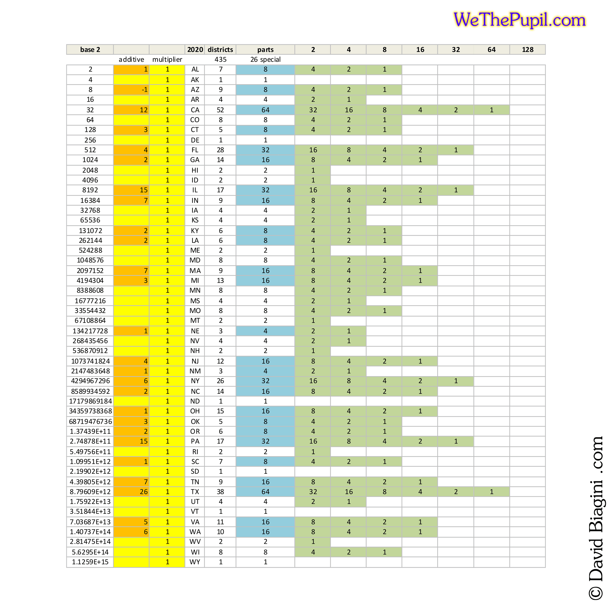
Unless it is now called New ‘America’ through some wasteful and demented rumplican gulf like renaming agenda, New Mexico is exampled here, shifting the goal of three districts up to four.
With four equal populated portions, the next step is to further subdivide each into the end goal of three parts of equal population. For a balanced fairness, a pie chart seems best, with the pole being situated either randomly, population centered, or guided human choice. In this example four multiplied by three will render twelve.
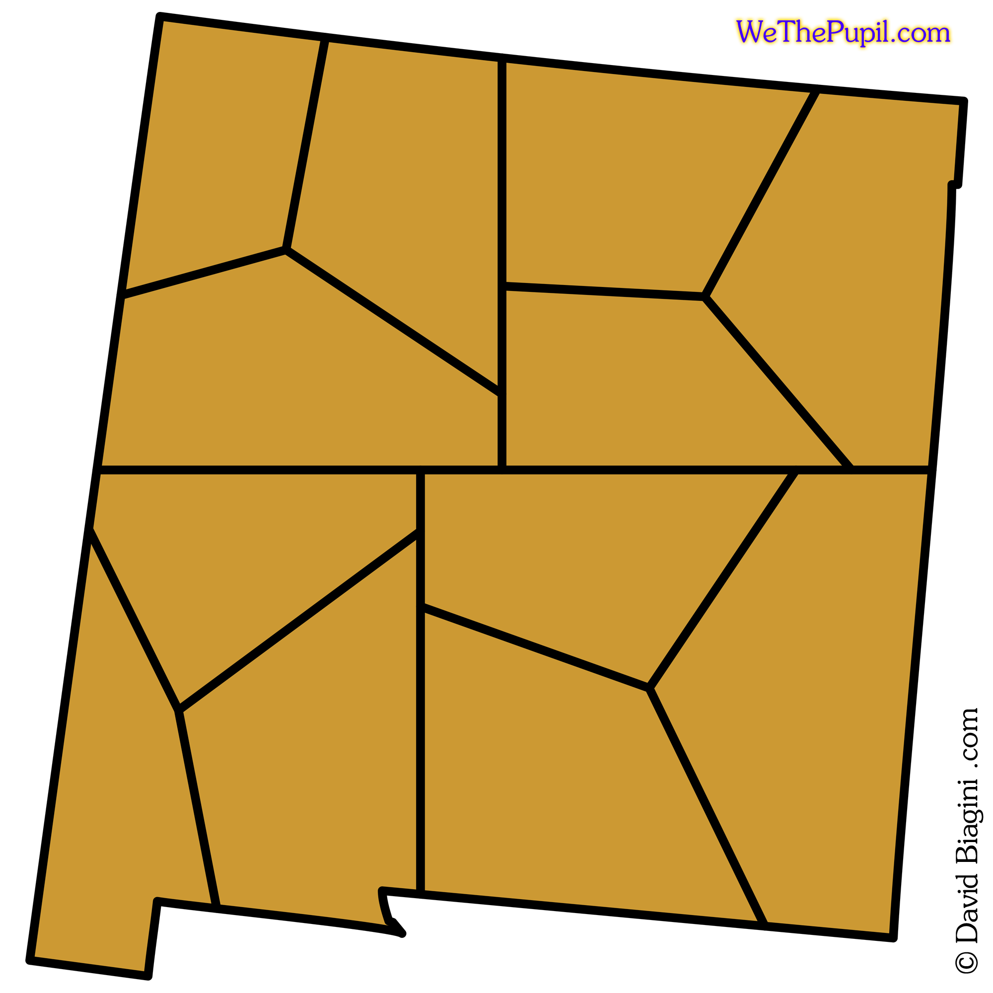
Next the objective is to connect the smaller regions in such a manner as to form a simplified and relatively square footprint consisting of the base two number utilized, in this case four.
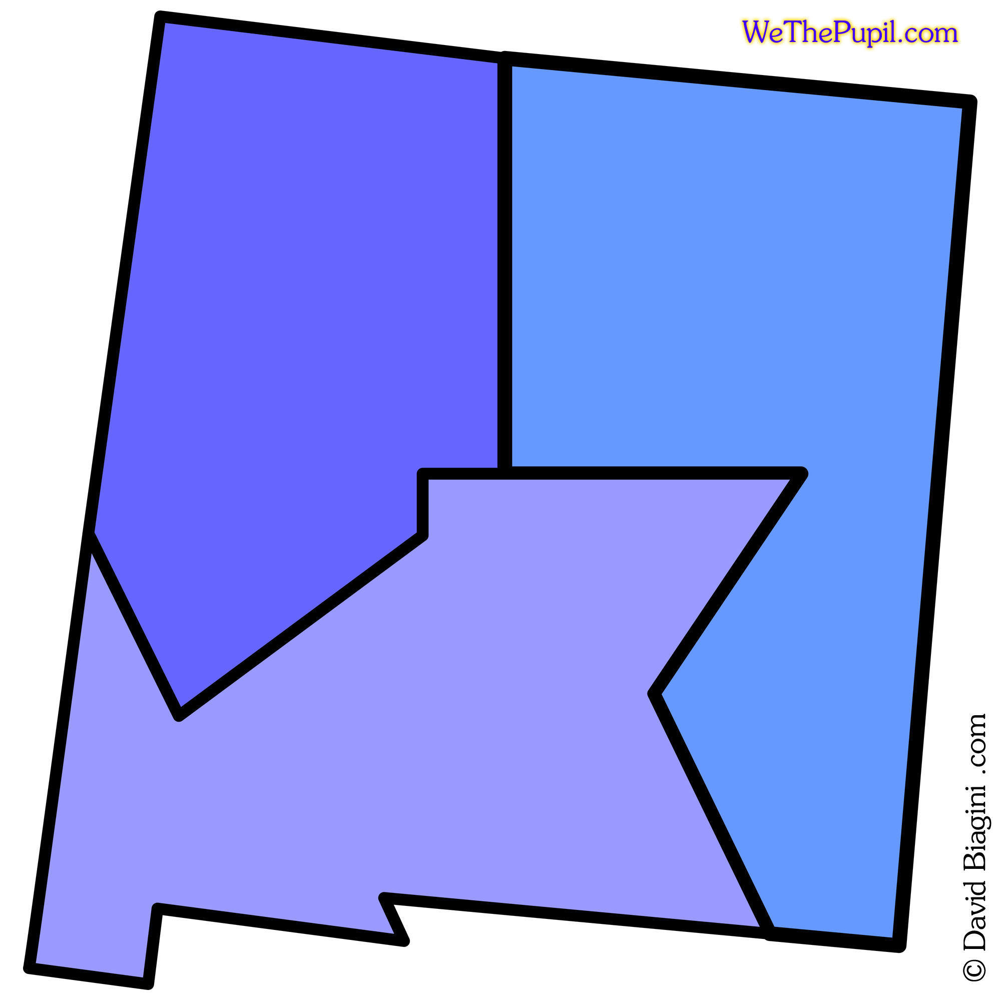
The goal of a simplified border is accomplished, yet as can be seen the areas are not square, but there is none of the ‘worming’ that occurs with the following of physical landscape formations or political gerrymandering.